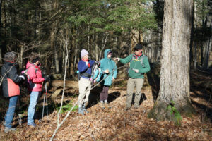
An Outdoor Adventure with Ranger Bill – Pixie Falls January 2023
If you’re looking for a nice winter hike to a unique location let me suggest the Blue-Blazed Nipmuck Trail in Ashford to Pixie Falls. The falls are created by Boston Hollow Road Brook as it drops about 40 feet in elevation, tumbling around rocks and through a stand of tall hemlocks. During winter the formation of ice along the edges of the falls is beautiful. The falls gets its name from the trail steward who maintained that section of the trail and named the falls after his trail companion, his dog Pixie. To reach Pixie Falls you can either hike the Nipmuck Trail southward for about 2 miles or take the northward route for about 0.5 miles. The southerly route has a difficulty of rate moderate with some elevation and some “up and down” sections. That route also passes the northern terminus of the Natchaug Trail at 0.4 miles and at 0.8 miles a large erratic boulder left by the receding glacier from 11,700 year ago. It also traverses a section of the Old Connecticut Path, the Native American path that Reverend Thomas Hooker and his congregation traveled from Cambridge to Hartford in 1636. The spur trail to Pixie falls is on the left at approximately 1.3 miles. The northerly route is only about 0.5 miles and is rated easy with little elevation gain. The spur trail is on the right.
Directions:
Southern route parking area is on Eastford Road in Ashford. From Rt. 44 in Ashford take Rt. 89 north for 4.0 miles and then east (right) on Boston Hollow Road, at 0.4 mile on right take Eastford Road and trailhead is on approximately 0.5 mile on right. GPS: 41.9210750, -72.1625280.
Northern route parking area is on Iron Mine Lane in Ashford. From Rt. 44 in Ashford take Rt. 89 for 2.75 miles to Iron Mine Lane on right. Parking area is on left, 1,000 feet from intersection with Route 89. GPS is: 41.9024280, -72.1667940
Get Connected
Sign up for our newsletter
"*" indicates required fields


