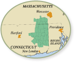
Water Trail Interactive Maps
Water Trail Interactive Maps
 |
 |
| Quinebaug River Water Trail in Google Earth |
Willimantic River Water Trail in Google Earth |
Instructions to see the Google Earth Interactive Water Trail maps:
Click on link, then:
In Internet Explorer, click “Open”
In Chrome, click on the downloaded file.
In Firefoox, select “Open with” and select Google Earth.
Install Google Earth to view these water trail maps!
With Google Earth you can see the Quinebaug and the Willimantic River Water Trails from satellite view complete with access sites, water trail segments, hazards, points of interest, portages, USGS Streamgauges and driving routes around the hazards.

