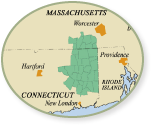
Shetucket River NRT – Plains Road to Salt Rock State Park: Ample parking at town rec fields for many cars. 50 foot carry to top of river bank, then 25 footlong steep incline to the water. This 7 mile segment is popular & scenic, passing railroad tracks, Route 32, and finally into a more wooded habitat, offering common sightings of eagles, osprey, muskrat, otters & more. A mile from the launch you’ll approach an island. Paddle to the east side (river left) through the wider channel. Pass under the Route 203 bridge (which can be used for an emergency exit only, but is not a public landing or launch location), and note that you will also pass the private Windham Fish); Game Club, which is not a public landing either. Five miles from the Plains Road Launch, paddlers must portage the Scotland Dam. DO NOT PADDLE OVER SCOTL AND DAM! The portage is on the western shore (river right), 350 feet long with the first 50 feet up a hill beside dam, then down a sloping path to launch location below the dam. This is a great spot to relax and rest up for the remainder of the paddle to Salt Rock State Park. Drier summer months can make the stretch below the dam very “bony.” Salt Rock State Park is approximately 2 miles from the dam on the eastern shore (river left). You can exit the river at Salt Rock by carrying your boat 300 feet from landing, through tunnel under railroad tracks to parking area. No fee.
Categories
- Paddling
Location
331 Plains Road
Windham, CT 06226


