Outdoor Adventures with Ranger Bill — Enjoying West Thompson Lake
In The Last Green Valley we are fortunate to have several U.S. Army Corps of Engineers (USACOE) project areas. I have hiked and paddled at each one and they provide an amazing resource for the public to enjoy. They were built in the last century for flood control following the devastating flooding of our region’s mainstem rivers within the Thames River Watershed.
Controlling the flow of the Quinebaug River are huge dams and impoundments at East Brimfield Lake (Holland/Brimfield), Westville Dam (Sturbridge/Southbridge) and West Thompson Lake (Thompson). Controlling the French River are Buffumville Lake and Hodges Village Dam (Oxford, Webster, Dudley and Thompson). The Shetucket River and its tributaries are controlled by Mansfield Hollow (Mansfield). Each of these large impoundment areas has the critical role of protecting downstream towns from floods, but they also provide exceptional outdoor recreation opportunities with boat launches for paddling and fishing, and hiking trails throughout the impoundment areas. Our USACOE areas encompass thousands of acres of land and comprise some of the largest swaths of unbroken forestlands in the region.
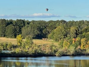
West Thompson Lake is only a few miles from our house, and we frequently hike there with our niece Alisha and her faithful dog Hazel. There are several hikes, from wooded smaller trails traversing though a mixed forest of mature hardwoods and conifers, to more open dirt roads with excellent views of the large lake and open sky. There are three main trail systems. The trail blazed with yellow markers is the Shoreline Trail, and a 4-mile loop around the lake, including a side trail Woodland Walk Trail marked with yellow markers with black triangles. The blue trail marks the Lost Trail a figure 8 that connects the shoreline trail with the campground. The trail blazed in orange marks the Ramsdell Woods Trail, a 2.2-mile trail north from the Dam to the Ramsdell Farm.
Information on West Thompson Lake and its recreation opportunities can be found at their website at: https://www.nae.usace.army.mil/Missions/Recreation/West-Thompson-Lake/ Trail maps of the entire property can be found at the right hand side of the website main page. I suggest you download the maps before heading out.
Along with hiking, West Thompson Lake USACOE project area includes a campground with 24 sites, a popular disc golf course, and a large boat launch area. One of my favorite paddles is a five-mile paddle from the Quinebaug River boat launch in the Fabyan section of Thompson to West Thompson Lake boat launch. A brochure about this paddle is provided by the USACOE can be found at The Last Green Valley website at the following link: https://thelastgreenvalley.org/wp-content/uploads/2014/10/QuinebaugRiverTraiFabyanThompsonBrochure.pdf
I will be leading this same paddle on May 13 as part of Spring Outdoors. Email me at bill@tlgv.org to register or learn more. I hope you’ll join me at West Thompson Lake and enjoy the variety of outdoor recreation offered there. Camping, fishing, hiking, paddling, and even disc golf are available for all of us to enjoy. There are also 2 pavilion buildings available for renting to programs and functions. We are fortunate to have these several USACOE properties here in The Last Green Valley. I hope you’ll take the time to visit one soon.
Get Connected
Sign up for our newsletter
"*" indicates required fields


