Canterbury Has Unique History, Resources
Soon after moving to northeast Connecticut in 1981, I drove Route 169 south from Woodstock through Pomfret and Brooklyn and into Canterbury, enjoying picturesque small towns, quintessential New England architecture, farms, orchards and vistas of soft rolling hills. That day was my first time traveing the stretch of road that would become a national scenic byway, and it remains pretty much the same today as it did when I first experienced it more than 35 years ago.
My first journey south on Route 169 to Canterbury was to visit the Prudence Crandall Museum to learn more about the courageous Quaker woman who came to symbolize the early turbulent years of the abolitionist movement leading up to the Civil War. Crandall dared to educate black girls in her home on the Canterbury Green in 1833 and is memorialized as the state heroine for her actions. I have been to Canterbury many times since that first visit and will return today for the town’s Canterbury Old Home Day on the town green from 10 a.m. to 4 p.m.
Canterbury was originally part of Plainfield, but it separated and incorporated as a town in 1703. Records show Robert Green sold 3.5 acres near his home for 30 shillings “to build and erect a meetinghouse on, or for training, or for any other use the said inhabitants of Canterbury shall see a use for.” Today, the town green encompasses the historic structures within the general area of the intersection of Routes 169 and 14.
Along with the Prudence Crandall Museum there are several other historic structures of note, with many on the National Register of Historic Places with examples of Colonial, Greek Revival and Victorian architecture.
Another notable local is Moses Cleaveland, who was born in Canterbury in 1754. During the American Revolution he joined the 2nd Connecticut Regiment and became captain of a newly formed support unit, the Army Corps of Engineers. An experienced surveyor, he was one of 36 founders of the Connecticut Land Co. that purchased a large tract of land in northeastern Ohio along Lake Erie. He surveyed the tract that would come to be called Cleaveland. Eventually, the first “a” in the name was dropped; supposedly when the town’s first newspaper was designed, the name was one letter too long to fit the masthead and the abbreviated spelling passed into common use.
The defining natural feature of Canterbury is the Quinebaug River, which delineates the town’s northeastern boundary with Plainfield. I have paddled the Quinebaug in Canterbury on several occasions and highly recommend it to avid paddlers.
From a canoe launch at the Quinebaug Valley Trout Hatchery in Central Village to Robert Manship Park in Canterbury is a five-mile stretch of some of the most interesting and somewhat challenging stretches of the river. There are several riffle and rapid sections, large rocks, thickly wooded hillsides, and virtually no houses within view until you near the landing at Robert Manship Park. This section of the river includes the Quinebaug Wildlife Area, and I frequently encounter bald eagle, great blue heron, belted king fisher, and osprey on this stretch. In my opinion, it is the most scenic paddle in the entire National Heritage Corridor.
From Robert Manship Park to the landing just off Butts Bridge Road is another beautiful five-mile stretch though a more gently meandering paddle, especially as you enter the large impoundment of Aspinook Pond.
Today is Canterbury’s Old Home Day, and I’ll be there with the The Last Green Valley Ranger Information Booth. If you’re looking for a fun day, beautiful scenery, and lots of interesting, history-related exhibits and tours, then I suggest you make the trip to Canterbury.
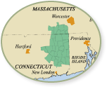
Like the other 34 towns that comprise The Last Green Valley National Heritage Corridor, Canterbury has its own unique history and special cultural resources. However, to really understand the region’s history is to look beyond each town’s individuality and take in the great sweep of time and regional shared past. To know Canterbury is to better understand Plainfield, to know Lebanon is to better understand Woodstock and so on. History is not defined by boundaries, but by the steady march of time.
Much of our history is tied to our landscape. To paddle the Quinebaug River in Canterbury is to follow a river that has shaped history as it flows from its headwaters in Massachusetts to its terminus in Norwich, where it joins the Shetucket River and eventually makes its way to Long Island Sound.
The Quinebaug flows over dams built to harness the energy that powered the Industrial Revolution, bringing countless immigrants to our region. In several locations, just below the water surface are the stone remains of fishing weirs built hundreds, if not thousands, of years ago by the original inhabitants of our region. To paddle the Quinebaug River is to paddle through our shared history.
Every day provides another opportunity to explore and experience our region. We are fortunate to live in this exceptional place called The Last Green Valley National Heritage Corridor. I hope you’ll join me and other as we work together to care for it, share it, and pass to others this special place we call home.
Information for this column was gleaned from three The Last Green Valley’s publications, “For the Common Good: A Guide to the Historic and Scenic Town Commons & Greens of The Last Green Valley”; “Notable and Notorious: Historically Interesting People from The Last Green Valley”; and “Paddle Guide for the Quinebaug, Willimantic, and Shetucket River Water Trails.”
Bill Reid is the Chief Ranger of The Last Green Valley National Heritage Corridor. He has lived in the region for more than 30 years and can be reached at bill@tlgv.org
Get Connected
Sign up for our newsletter
"*" indicates required fields


