Fenton River a Beautiful and Essential Resource
“A river comes from somewhere, flows past my wondering eyes, and goes on to some other place. It has movement, change, and there is a sense of both time and eternity in it. The river tells me that so long as there are heights and lowlands on earth, water will continue to flow and life will persist.”
– Hal Borland, Beyond Your Doorstep: A Handbook to the Country
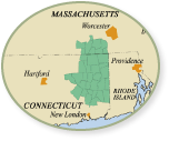
The Last Green Valley National Heritage Corridor is divided by the Quinebaug River and Shetucket River valleys, our large, “main stem” rivers within the Thames River watershed. Smaller rivers feed into the Quinebaug and Shetucket rivers and together help define our region as rich in water and aquatic resources.
For the original inhabitants of the region, the rivers provided transportation and food. During the Colonial era, the rivers provided power for grist and sawmills and then drew immigrants from around the world during the industrial age of the 19th and 20th centuries.
I have paddled our larger rivers from their headwaters to where they join other rivers on their journey to the ocean. I paddled the Thames River from Norwich to Long Island Sound and have enjoyed countless hours exploring our region by paddle power. Any day spent on a river is a good day.
There are some rivers that, due to their smaller size and wooded locations, are not easily navigated by paddle craft. Yet, they are critical to the natural resources of our region, providing important wildlife habitat and outdoor recreational opportunity. Some rivers are also an important source for drinking water. The Fenton River exemplifies all of these traits.
A mid-sized “forest river,” the Fenton flows for 18 miles from Willington to Mansfield, where it empties into Mansfield Hollow Lake at Mansfield Hollow State Park. Along the way, the Fenton is crossed by routes 84, 74 and 44 and is fed by smaller streams, such as Kidder Brook, Taylor Pond, Curtis Brook, Mason Brook and Fishers Brook.
Mansfield Hollow Lake is also fed by two other mid-sized forested rivers, the Natchaug and the Mount Hope. Water from Mansfield Hollow flows into Willimantic Reservoir then continues as the Natchaug River for a few miles before joining the Willimantic River to form the Shetucket. The Shetucket River flows southeasterly, meeting up with the Quinebaug River in Norwich then flowing to Norwich Harbor. From there, it joins the Yantic River to form the Thames River, which carries water from the entire watershed out to Long Island Sound.
I first encountered the Fenton River while hiking along the Nipmuck Trail from Mansfield Hollow, past the Gurleyville Gristmill in Mansfield, and then to Route 44 near the Mansfield and Willington border. For several miles, the trail runs adjacent to the river and the sound of babbling water and the wildlife attracted to the riparian habitat make this stretch of forest trail one of the more enjoyable in our National Heritage Corridor.
The forest canopy along this section of river is dominated by Eastern hemlock and white pine that shade and cool the water and forest floor. There are several locations where hikers can stop along the trail to rest along the banks of the Fenton. The Gurleyville Gristmill site is owned by Joshua’s Trust and offers the perfect starting point for either a northerly or southerly saunter along the Nipmuck Trail and Fenton River.
On one such occasion, I was about a half mile south of the Gurleyville Gristmill when a shrill whistling sound from a tree startled me. I stopped and crouched down for a better look when suddenly an osprey left a branch and flew up through the tree line above the river. I have seen osprey many times on larger, more open rivers, ponds and lakes, but was surprised to see one in such a closed forest canopy. Clearly, the fishing is good in the Fenton.
Those who enjoy fishing and are looking for a good trout river will be interested to know the state Department of Energy and Environmental Protection Fisheries and Wildlife Division stocks the Fenton with trout in 20 different locations. The 2016 DEEP Stocking Report indicates 6,638 brook trout, brown trout and rainbow trout were released into the Fenton.
The Fenton River is not just enjoyed for scenic beauty and recreational opportunities, but also as a source of drinking water. The University of Connecticut Storrs campus draws water to meet its daily water consumption needs from wellfields along the Fenton River to the east and the larger Willimantic River to the west of the university.
To learn more about the Fenton River, I contacted Eric Thomas, watershed manager, Bureau of Water Protection and Land Reuse for DEEP. He helped me better understand water use issues related to UConn and the Fenton River.
During drought conditions in summer 2005, the Fenton River went dry during a well-documented no-flow event in proximity to UConn’s wellfields. As a result, this section was assessed by DEEP as not supporting aquatic life based on inadequate flow.
Following this no-flow event, DEEP entered into an agreement for an instream flow study, and eventually entered into a consent agreement with UConn and the Connecticut Department of Public Health for a review and update of a comprehensive water supply and demand management system of the wellfields along both the Fenton and Willimantic rivers.
The university recently expanded its water supply system with a permitted consumptive water diversion through the Connecticut Water Company and its Shenipsit Reservoir and transmission line system.
Years of experience have led Thomas to believe, “local communities now have a broader appreciation for the interconnections between the myriad Fenton River resources, and they work amongst themselves and with others to better address competing needs along the Fenton River and its watershed lands.”
Thomas highlighted extensive community outreach work done by the former Green Valley Institute – which was a joint program of TLGV and UConn — and later by the community-initiated state greenway designation of the Fenton River by the Connecticut Greenways Council. He said, “local agency and landowner participation in the forward-thinking Natchaug River Conservation Action Plan and advisory Conservation Compact (2009) added positive steps forward to long-term conservation and wiser use of the river and watershed resources. All that work and more continues on today.”
I also contacted Jean Pillo, watershed conservation project manager for the Eastern Connecticut Conservation District and TLGV’s water quality monitoring coordinator, to get her insights into the future of the Fenton River and the watershed it shares with the Natchaug and Mount Hope rivers.
Pillo is pleased to report the Eastern Connecticut Conservation District has been awarded the first Healthy Watershed Initiative Grant in Connecticut. Once the contract is activated, ECCD staff will be working with towns within the Upper Natchaug River watershed, which includes the Fenton and Mount Hope rivers, to develop strategies for preventing future development from negatively impacting water quality in this high-quality river system.
For several years, I have enjoyed the Fenton as a beautiful natural feature for a hike along the Nipmuck Trail, as well as for the riparian flora and fauna it supports. Thanks to Thomas and Pillo, I have a new appreciation for the Fenton River as a critical drinking water supply for UConn and as a “flowing” symbol for how diverse groups of people came together to better understand its importance as a drinking water source and implement protections to preserve this essential water resource for the future.
Our rivers are the circulatory system bringing life-giving water to our lands and to our bodies. I hope you’ll join me and many others as we care for and enjoy our most valuable natural resource. Let us also work together to pass on this beautiful place we call home – The Last Green Valley.
Bill Reid is the Chief Ranger of The Last Green Valley National Heritage Corridor. He has lived in the region for more than 30 years and can be reached at bill@tlgv.org
Get Connected
Sign up for our newsletter
"*" indicates required fields


